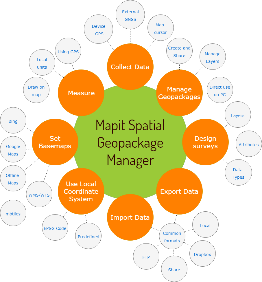
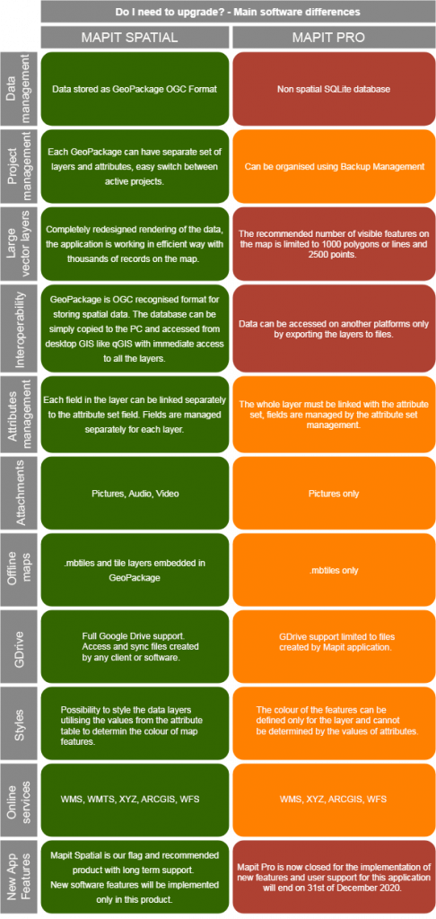
Mapit Spatial is an Android application with the functionality similar to our most popular app called “Mapit GIS – Data Collector” but with completely redesigned data management approach.
Full user guide for Mapit Spatial is now also available.
The app is designed to be simple and light, driven by new OGC file format for storing spatial data called GeoPackage.
Directly from the application you can access multiple geopackages data sources and their content presented as tiled or feature layers.
You can also create new geopackage databases and feature layers and link their fields with the attribute set fields, so the data can be then collected using forms containing dropdown-lists, multiselect list, barcode scanner etc. Please see our website for more details.
The collected data can be accessed immediately by simply copying the whole geopackage file to the PC and linking to it from GIS Software like qGIS. You can also export your data to popular formats like geojson or shapefile.
The application is supporting multiple coordinates projections and you can specify your default coordinate system by providing the EPSG code in the settings – PRJ4 library is used to convert coordinates.
The application can be linked with high precision GNSS systems, so you can get down to centimeter accuracy if required.
Mapit Spatial can be used in number of applications including:
– environmental surveys,
– woodland surveys,
– forestry planning and woodland management surveys,
– agriculture and soils’ types surveys,
– road constructions,
– land surveying,
– solar panels applications,
– roofing and fencing,
– tree surveys,
– GPS and GNSS surveying,
– site surveying and soil samples gathering
– snow removal
– geological surveys and more…