Skip to content

Mapit Spatial - Geopackage manager

  • Home
  • Articles
  • Changelog
  • User Guide
  • Translations
  • User Stories
  • Contact Us
  • Home
  • Articles
  • Changelog
  • User Guide
  • Translations
  • User Stories
  • Contact Us

Mapit Spatial - Geopackage manager

Enhanced productivity and spatial data management

  • Articles / Mapit Spatial

Direct Export to PostgreSQL database

by osedok · Published 2019-02-08 · Updated 2022-04-19

Mapit Spatial is capable of exporting the data directly to PostgreSQL database. The remote database must have PostGIS extension installed and username used must have necessary permissions to create/update spatial tables.

There are 3 easy steps to get the export set on the device:

1. Set the database connection in Mapit Settings->Remote Connections section. The required parameters to create the connection are host IP or valid domain, port, username, password and database name. You should be able to connect to the database using the above parameters in software like qGIS to test if the database is set properly.

2. After selecting the layer in ‘Geopackages->Layers’ section please chose ‘Export’ from the context menu and select ‘Export to PostgreSQL’ option on the list.

3. In the next step you can select from two available options shown on the picture below:

Following successful export you should be able to see the message similar to the one on the picture below:

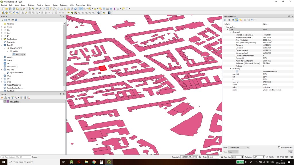
After the data is exported to the database you can access it’s records immediately from any software capable of connecting to PostgreSQL like qGIS:

You can also explore and access the data in PgAdmin:

Share this:

  • Click to share on Twitter (Opens in new window)
  • Click to share on Facebook (Opens in new window)

Related

Share

Tags: DataExportPostGISpostgresqGISRemotesql

Follow:

  • Next story Applying Styles
  • Previous story External GNSS Connection

Navigation

  • Articles
  • User Guide
  • Get Mapit Spatial
  • Roadmap
  • Changelog
  • Translations
  • Contact Us
  • Mapit GIS Privacy Policy
  • User Stories

Recent Posts

  • Hiking the European Continental Divide with mapitGIS Spatial
  • Mapit Software – EULA
  • Mapit-Spatial – Google Drive Sync
  • Mapit GIS Privacy Policy
  • Applying Styles

Mapit Spatial - Geopackage manager © 2025. All Rights Reserved.

Powered by  - Designed with Hueman Pro


Loading Comments...